Two sets of rules
A restump answers to two systems. The Building Act 1975 decides whether the work needs a building development permit from a certifier; the approvals page covers that. The Toowoomba Regional Planning Scheme 2012, now at version 28.0, decides whether the work also needs planning assessment, and it does that mostly through the overlays in Part 8. Most restumps never touch the planning scheme at all. The ones that do are usually a raise, an enclosure under the house, or a job on a listed or character place, on a flood-prone block, or on a steep one.
Council's zones and overlays page lists the overlays: airport environs, bushfire, landslide hazard for steep or unstable land, flood hazard, heritage, neighbourhood character, scenic amenity, environmental significance, water resource catchment, agricultural land, extractive resources and regional infrastructure corridors. All of them are mapped at maps.tr.qld.gov.au, where you can search an address and see what applies. Since 16 February 2026 a Temporary Local Planning Instrument, TLPI 01/2026, has set a table of assessment for building works under the scheme.
| Overlay | What it can mean for a restump, raise or underpin |
|---|---|
| Heritage | Applies to specific Local and State Heritage Places. Like-for-like restumping usually sits outside the code; raising or changing the under-house enclosure can be assessable. Pulling down a listed place is generally impact assessable. |
| Neighbourhood character | Applies to mapped streetscape areas and specific Neighbourhood Character Places under Planning Scheme Policies 6 and 7. Same position as heritage: stumps alone are usually fine, a raise or an enclosure that changes the street view may not be. |
| Flood hazard | Sets minimum floor levels above the defined flood event and rules out slab-on-ground in low risk areas. Matters for any raise and for what can be built under a house. |
| Landslide hazard | Steep or unstable land, mostly the eastern escarpment. A geotechnical engineer may be needed before the certifier issues a permit. |
| Bushfire | Edge-of-town and escarpment blocks. Affects construction standards for new work more than the stumps themselves. |
| Airport environs, scenic amenity, the rest | Rarely touch a restump. A raise near the airport or on a ridge may be checked against them. |
Heritage and character places
Toowoomba has 64 places on the Queensland Heritage Register: 29 in Toowoomba City, 10 in East Toowoomba and 7 in Newtown, with the rest spread across the region. The planning scheme adds its own Local Heritage Places and Neighbourhood Character Places. Council's register of heritage and neighbourhood character places explains how the two overlays work: the heritage overlay applies to specific properties nominated as Local or State Heritage Places, and the neighbourhood character overlay applies to areas with a streetscape character and to specific Neighbourhood Character Places, with the detail in Planning Scheme Policy 6 and Policy 7. Toowoomba does not use a blanket pre-1946 rule, so the age of a house on its own does not put it under either overlay. The address does.
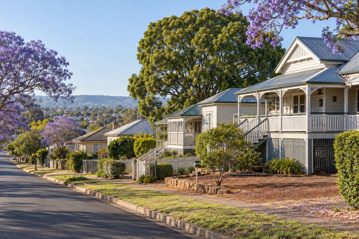
The position this site takes, and the one to test with council: like-for-like restumping that does not change the house's appearance or height is usually outside the heritage and character codes. The stumps are under the house, the floor stays where it was, and the street sees nothing different. Raising the house, or changing the under-house enclosure from open battens or lattice to a built-in lower storey, can be assessable, because both change what the place looks like. Council's removal of dwellings page says pulling down or removing a heritage or character place is generally impact assessable, and that for removal of any building council is a concurrence agency for a bond paid before the work starts, with drains sealed by a licensed plumber. Ask council's planning team before you raise or enclose; a phone call to 131 872 or an email to [email protected] before the engineer is engaged is cheaper than a redesign after.
The flood hazard overlay
Toowoomba flooded in December 2010 and again in January 2011, and the January event was largely a flash flood. On 10 January 2011 two storms merged over the city at about 11 am. The Bureau of Meteorology recorded 60 mm in the hour to 1.50 pm, with a peak rate of 144 mm an hour over ten minutes, and East Creek and West Creek overwhelmed the culverts that carry them under the city centre. Two people died in East Creek. The Coroner's findings on the south east Queensland floods set that out, and the flood hazard overlay in the planning scheme is where council's response to it lives.
Council's flood risk planning page summarises the Flood Hazard Overlay Code. In a low risk area the floor level must be at least 300 mm above the defined flood event and a residential building cannot be slab-on-ground. In a medium risk area the floor level is 500 mm above the defined flood event. In high or extreme risk areas no new buildings are allowed. In an overland flow path the floor level is 600 mm above the flow. For a house on stumps the first point is the useful one: a Queenslander with its floor on posts is the kind of building the code wants on flood-prone ground, and raising it is often the way to meet a floor level. The Queensland Government's Resilient Homes Fund steps for raising a home put council first in the sequence for exactly that reason: confirm the minimum habitable floor level, then the surveyor and soil tester, then the structural and geotechnical engineer, then the certifier, then the licensed builder.
What it means for a restump at the existing height: usually nothing, because the floor level does not change. What it means for a raise: the level you lift to is set by the code, not by the headroom you want underneath. And what it means for building under a raised house in a flood area: the floor level rules apply to the new rooms, and a habitable room needs a 2.4 m ceiling, which council's building advice is clear about. The Queensland Development Code sets an overall height limit for a house; the certifier confirms what it is for your block.
The landslide hazard overlay
The city's eastern edge is the escarpment of the Main Range, where the basalt drops away to the valley below. It is steep, it is wet on its eastern face, and it moves. The Geological Survey of Queensland's Record 1981/02, Land Stability on the Eastern Slopes of Toowoomba, documented instability there more than forty years ago, and a University of Southern Queensland report to council on slope instabilities in the escarpment examined the Fantail and Firetail tracks, Duggan Park and the head of Glen Lomond gully. The planning scheme's landslide hazard overlay covers steep or unstable land, and this site has not verified its full extent; the mapping at maps.tr.qld.gov.au shows whether a given block is under it.
On a block under the overlay, or on any steep block at the eastern edge of Rangeville, Prince Henry Heights, Mount Lofty or East Toowoomba, a restump, a raise or underpinning is likely to need a geotechnical engineer to look at the slope before the certifier issues a building development permit. Tall stumps on the downhill side, deeper footings and drainage that takes water off the slope rather than into it are the usual outcomes. The Rangeville page covers that side of town, and the soils guide covers the ground.
Bushfire and the others
The bushfire overlay covers the edge of town and the escarpment bush, and it mainly affects construction standards for new work rather than stumps under an existing house. The airport environs overlay can matter to a raise near the airport, where height is controlled. Scenic amenity can matter to a raise on a ridge. Environmental significance, water resource catchment, agricultural land, extractive resources and the infrastructure corridors are overlays a restump will almost never touch, but a block in Highfields, Crows Nest or out toward Oakey or Pittsworth can sit under one, and the map is the place to find out.
How to check your block
Search the address at maps.tr.qld.gov.au and turn on the overlay layers. Check council's register of heritage and neighbourhood character places for the house. If anything shows, ring council on 131 872 or email [email protected] and describe the job: restump at the existing height, raise, enclose, or underpin. Council's planning team says what assessment, if any, the planning scheme requires, and the certifier says what the Building Act requires. Do both before the engineer is engaged. The buying guide says the same thing to buyers, for the same reason.
What this page cannot do
It cannot tell you which overlays apply to your block; the mapping at maps.tr.qld.gov.au and council's planning team do that. It cannot tell you whether a particular house is a heritage or character place; council's register does. It cannot quote the overlay codes, because this site has not verified the exact text of the Heritage, Neighbourhood Character or Landslide Hazard overlay codes and describes them in general terms from council's own summaries. It cannot say what level a raise in a flood area has to reach; council sets the minimum habitable floor level for the block. And it cannot say whether TLPI 01/2026 changes the assessment of a given job. For all of it, council on 131 872 and a licensed building certifier.
Check the current rules before you rely on this
This page describes the Toowoomba planning scheme overlays that can affect restumping, house raising and underpinning. It describes the rules in general terms as they stood in October 2026. Standards, forms, thresholds and fines change.
The authoritative sources are Toowoomba Regional Council, understanding the planning scheme, Toowoomba Regional Council, planning scheme zones and overlays, Toowoomba Regional Council, register of heritage and neighbourhood character places, Toowoomba Regional Council, flood risk planning, Geological Survey of Queensland Record 1981/02, land stability on the eastern slopes of Toowoomba and Queensland Coroner, findings on the January 2011 south east Queensland floods. Where anything here differs from those sources, they are right and we are not.
We are not building certifiers, engineers, planners or lawyers. For what applies to your house, ask a licensed building certifier or ring Toowoomba Regional Council on 131 872.
Accurate at the time of writing, October 2026. Always check the source before relying on it.